 Đăng nhập bằng Google
 Đăng nhập bằng Facebook


 Tiếng việt
 English





WONAV CT Mobile Mapping System
 58
58
 0
0
 Bạn
Bạn 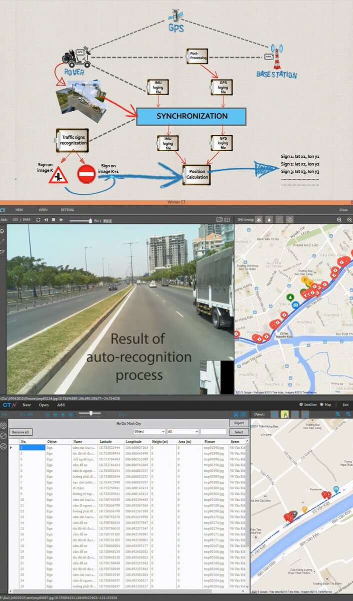


WONAV CT: is a mobile mapping system that collects data for GIS application. WONAV CT system includes both hardware and software components. The hardware has a Rover mounted on the roof of a car to collect GPS, Photos, and IMU on the road; and a Base Station mounted on a high position (i.e. the top of a building) to collect GPS data, which will help enhance precision of GPS collected by the Rover after a post-processing step. The software processes GPS, IMU and Photos to auto-recognize traffic signboards and calculate their coordinates by interpolating from the coordinates of the photo, true heading (from IMU data) and distance measured by pixels in the photos...Besides that the system can also give the following outputs:
- Coordinates of an object (traffic signboards, trees, address signboards...)
- Distance between two points on the road (wide of the road, distance between two lamp posts...)
- Height of an object (lamp post, tree, building...)
- Area (a damaged area on a road, a window, a wall...)
The outputs of WONAV CT can be used as inputs for many GIS applications of different fields

Top hồ sơ nổi bật

App đặt hàng cho quán trà sữa 1102
Lê Xuân Lộc


Quảng cáo